Date: October 26, 2021 1pm AZ/2pm MDT
Presenters: Jim Malusa, University of Arizona, with an introduction by Don Falk, University of Arizona
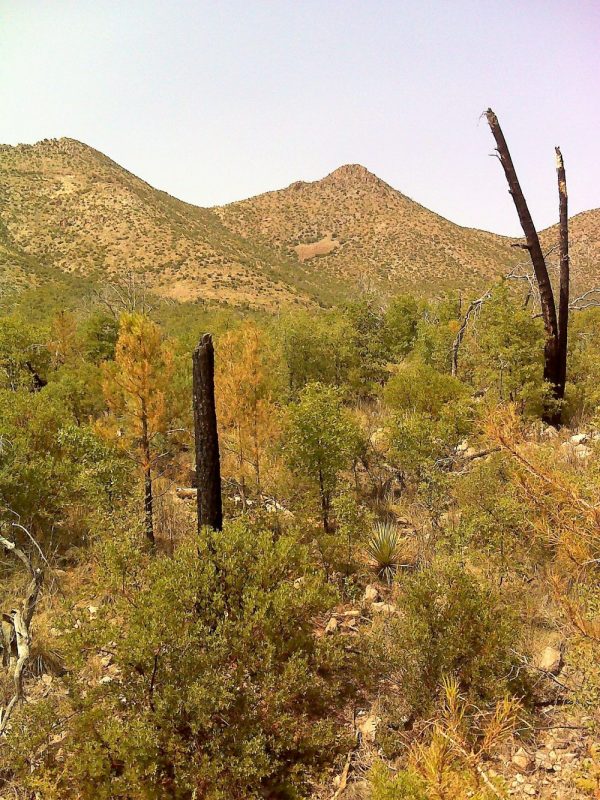
While making a vegetation map of the Chiricahua Mts in 2010, I took georeferenced photos and notes on the canopy cover of dominant species, in ecosystems ranging from grassland to spruce-fir. The next year, 2011, the Horseshoe 2 fire burned 220,000 acres of the Chiricahuas. Soon afterward I realized that I should return to the same locations and document the changes with repeat photography every two years. The resulting collection of images documents both a rapid return to former community composition – e.g., grassland – as well as evidence that some things may never be the same – e.g., Madrean pine-oak. Why? The possible casual factors include the usual suspects: resilience of certain suites of species, refugia and seed sources, and changes in the relative roles of winter vs summer precipitation. Burn severity is another obvious factor; not so obvious is the effect of repeat burns. To further investigate multiple burns in forested ecosystems, I’ve initiated a similar repeat-photography effort in the thrice-burned Santa Catalina Mts (2002-3 and 2020) as well as other Sky Island ranges. With Don Falk and his MS student Emily Fule, we now have detailed ecological and soil data that may explain some of these changes. To register for this webinar now, click here!