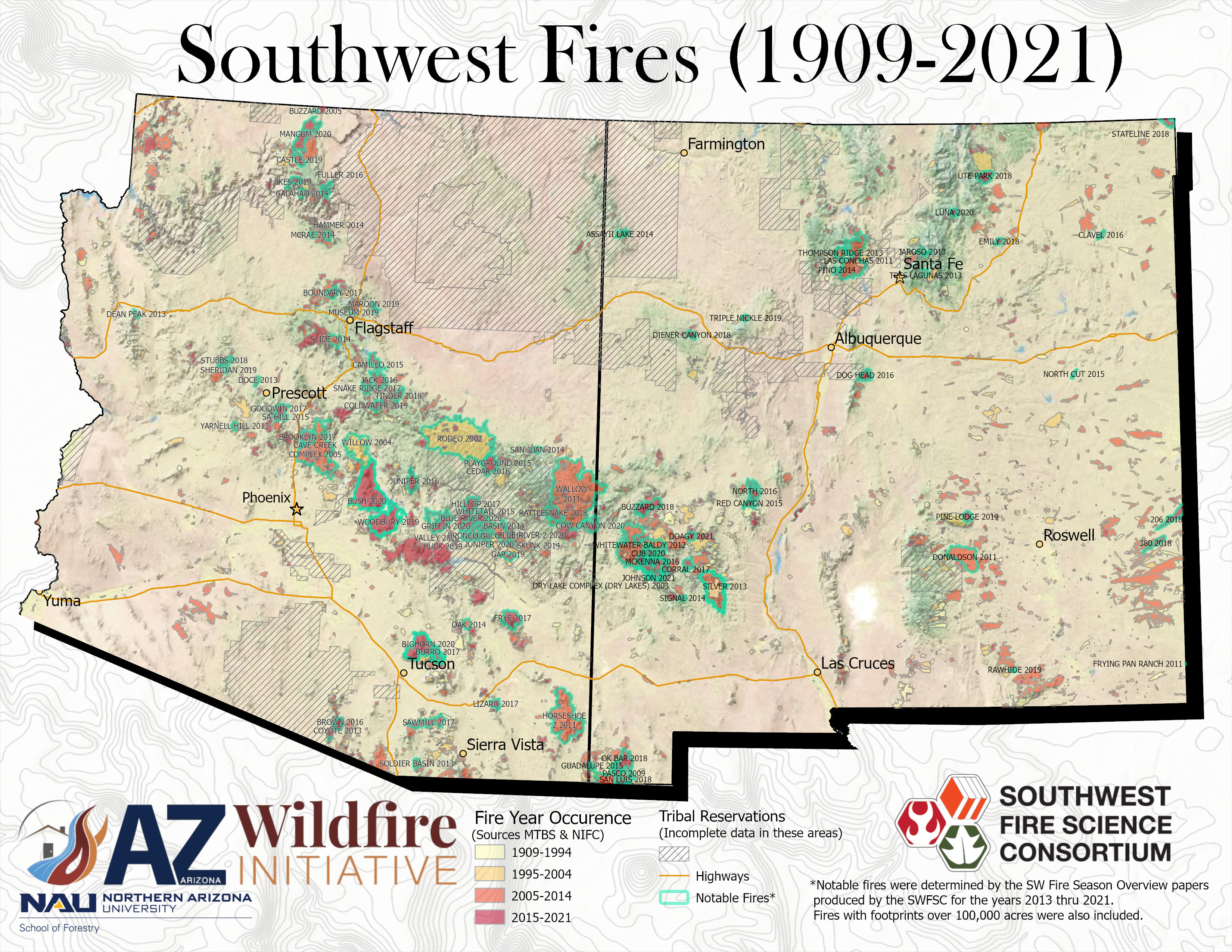
Explore maps of the most notable fires in Arizona and New Mexico 1909*-2021. Shown are the fires listed in our Wildfire Season Overview products as well as any fire over 100,000 acres. All of the maps are georeferenced and can be put on Avenza or a similar app to be utilized on a mobile device!
*The available AZ data goes back to 1910 while the NM data goes back to 1909.
To view PDFs of the maps, view the links below:
Southwest Fires (1909-2021): A combined map of Arizona and New Mexico
Arizona Fires (1910-2021)
New Mexico Fires (1909-2021)